Do You Remember Life Before...

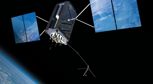
...The Global Positioning System (GPS)
first implemented for the US military as NAVSTAR-GPS in 1973
made publicly available in 1983
fully implemented in 1995

GPS

Registered users can log in to post comments or submit items for the galleries.

Login Register

There are 10 comments for this item.

Posted by notsteve at 8:15 am (PDT) on Sat July 20, 2019   
@GrandpaMike
GPS is actually very accurate, to about 30cm/11.8".
Any perceived inaccuracy will be the fault of the receiver (those made before 2018 aren't that accurate), or with the mapping software they contain.
Posted by GlenEllyn at 9:47 pm (PDT) on Mon June 10, 2019   
@GrandpaMike - That's a shame. I love old maps and I'm always amazed at how things have changed in just a few short years.
Posted by GrandpaMike at 10:09 am (PDT) on Mon June 10, 2019   
I loved maps as a younger man but it's been a while since I used one. Sometimes GPS isn't quite accurate but I don't think a map would be much better.
My dad died in 2000 and my sisters and I were tasked by his wife (not my mom) to clean out a room in her house and I found a box with at least 20-30 folded maps. They had done lots of RV traveling. I thought it would be fun to look at them but for some reason, she (or someone else) tossed the box away and all the maps went bye-bye. I was sad that I wouldn't get to look at them.
Posted by GlenEllyn at 9:20 am (PDT) on Sat May 11, 2019   
@CJ Tee-hee. At 5 or 6, you better be looking at the maps!

I have an atlas from 1910 that my grandson and I have pored over for hours. It's interesting to see the many changes in countries, but also fascinating to read the population numbers for cities around the world. It lists every U.S. town having a population of 5,000 or more. At that time, Grand Forks, ND had more residents than Miami, FL. Sort of blows your mind.
Posted by CJ at 8:19 am (PDT) on Sat May 11, 2019   
@GlenEllyn - I too, has always had an affinity for and a fascination with maps. As a young boy (5-6 yrs old) I'd spend more time looking at the maps in National Geographic than the topless natives. Yes!, as I got older my priorities changed (LOL) but still to this day I enjoy looking at maps.
Posted by GlenEllyn at 9:58 am (PDT) on Thu May 9, 2019   
@Duff, Folding a map isn't that difficult, is it? But it does take patience. I've always had an affinity for maps. My 10-year-old grandson loves them, too. The two of us like to spend time together just looking at them, wondering about the names of places and how they might have come to be.
Posted by Duff at 11:25 am (PDT) on Thu April 4, 2019   
Of course, the paper maps couldn't tell you anything about road closures or current traffic conditions. I did enjoy being the only one in the family who could fold them up properly. tongue-out
Posted by CJ at 10:46 am (PDT) on Thu April 4, 2019   
@GlenEllyn - I drove semi cross-country for several years in the early 70's and got around quite well without GPS. You are so right that with a paper map you had a better perspective between where you are and where you need to go. Also you could usually find better routes than what the GPS gives you.
Posted by GlenEllyn at 7:42 am (PDT) on Wed April 3, 2019   
Same here, CJ. I like using my brain to decide which route to take. Also, paper maps give a better perspective on where you are vs where you want to go. It helps to know that X is west of Y, etc.
Posted by CJ at 4:47 pm (PST) on Fri February 22, 2019   
I still prefer the the foldable paper maps. At least my map never told me to make a left turn while in the middle of a bridge.

Registered users can log in to post comments or submit items for the galleries.

Login Register